
As some of you know, I am a bit of a nerdy geek regarding technology (sometimes known as tech). So, I took a bit of a leap last week, and I’d like to introduce you all to my new friend, Eugene.
Eugene is a DJI Mini Pro 3, and I hope he will be the first of many Unmanned Aerial Vehicles (UAVs) in the Not Just CAD! family. This side of current technology fascinates me, and I want to investigate it further. A move to a lovely part of the UK has also brought this about, as I would love to endeavour to get some drone footage of our beautiful coastlines. Even though, as I write this, we have high winds and horizontal rain, which does prevent a drone flight, sadly.
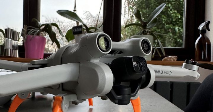
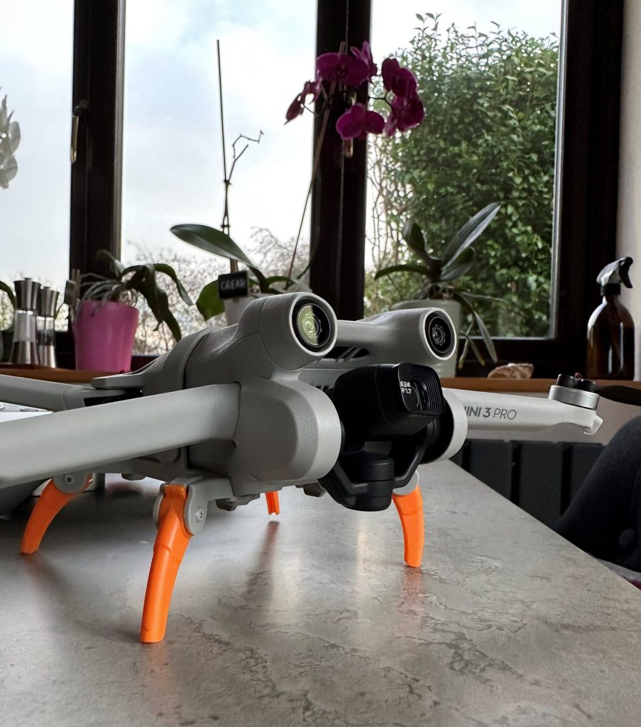
Why Eugene? Well, if you look at Eugene sitting on the table, I have purchased some additional landing gear (note the orange legs) for any rough terrain we might encounter, plus it stops the body of the drone from ending up in wet sand, should a landing be required.
I have kids and grandkids, and they have all taken us through the Spongebob Squarepants phase, and the Krusty Krab restaurant in the TV show is run by Mr Krabs, whose full name is Eugene Harold Krabs. We thought with the orange landing gear, he looked like a crab, so Mr Krabs is informally known as Eugene.

Reality Capture
Drones, and other associated technologies, such as LiDAR and photogrammetry, are becoming increasingly prevalent in numerous industries, as they allow for a 3D model to be created from various mediums, thus enhancing accuracy and quality. This, in turn, increases productivity and provides massive time savings. It also improves safety on more hazardous projects, as the drone can enter unsafe areas.
According to the Autodesk website, Reality Capture (RC) is defined as follows: –
“Reality Capture is a photogrammetry software solution that helps you create 3D models from photographs or laser scans. Reality Capture vastly improves productivity, accuracy, quality, and safety throughout the project”.
You can find more information and an Autodesk white paper here: –
https://www.autodesk.com/campaigns/reality-capture
Autodesk has their own RC software called ReCap Pro, and the 2023 version of the software is available on its website here.
As I am already an Autodesk user, I thought this would be the best place to start, but there are many applications that allow you to take your drone footage and start the conversion process into a 3D model.
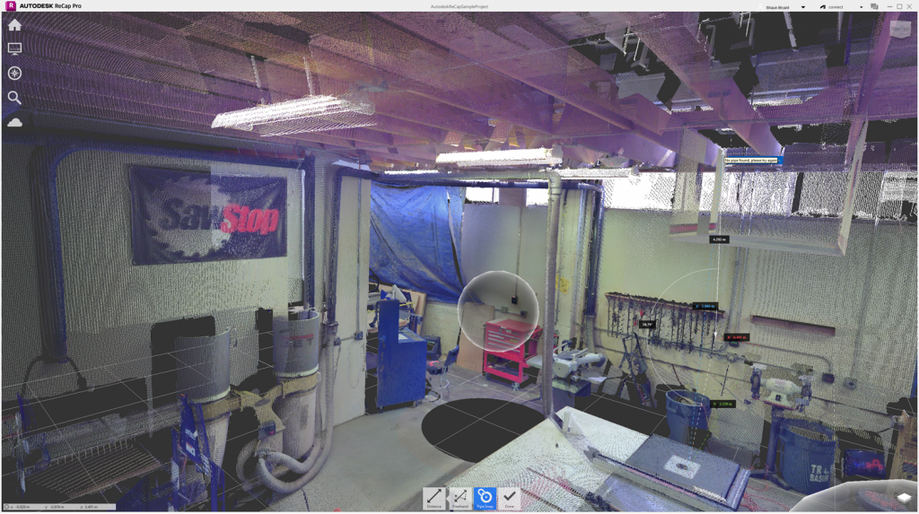
The above image gives you a quick insight into the captured data and how it can be utilized. Autodesk ReCap Pro shows you a workshop that has been captured and can now be used to measure distances and areas. And talking of captured data, you get the whole capture in its entirety, thus removing the worry that you might have forgotten something and need to visit the site again. How many times have you had to do that when you realise that you didn’t measure something important? Reality capture removes that worry. Great, huh?
How does Reality Capture work?
Eugene has a 1080p 4K camera built in.
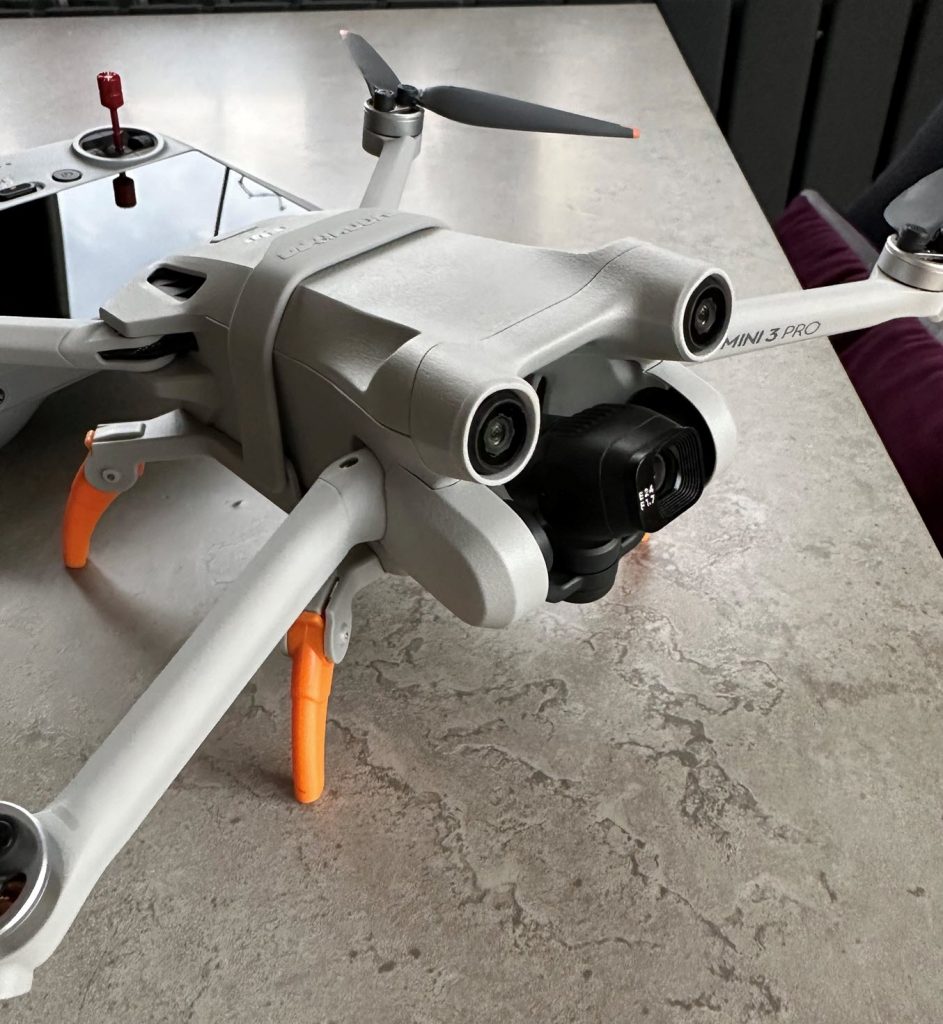
This means that not only can I record movies of the grandchildren running along the beach, but I can capture any site, structure, or topography that I need to. As it’s in movie format, each frame can be utilized to extract data, and Reality Capture and those hundreds of overlapping high-resolution digital images can be processed and combined using photogrammetric techniques to create a 3D mesh of the object or building.
A laser scanner can also be used, using a technique known as LiDAR (which is an acronym for Light Detection And Ranging). It is also known as 3D laser scanning. The scanning equipment is often tripod-mounted for 360 degrees of movement. It works differently by measuring hundreds of thousands of discreet points to define the shape and size of the object or building. Wikipedia gives a superb, in-depth explanation of LiDAR here.
Many organizations now combine these methodologies (and other methods) to generate what is known as a digital twin.
This then leads to what is known as Mixed Reality Capture. This blends digital twins, 3D models, and live feed video to create what is classed as an immersive experience. Wearable technology is often used, such as Virtual Reality (VR) goggles, and the operator can then blend virtual objects into the live environment that is within their field of view.
What are the benefits of Reality Capture and 3D Scanning?
Imaging-based scanning using UAVs such as Eugene provides rapid, safe, and non-invasive data collection, which can then be utilized to create high-context data sets. Imaging-based scanning uses overlapping high-definition imagery (Eugene = 1080p 4K) to create 3D meshes and point clouds. This data would then be fed into an application such as Autodesk ReCap for photogrammetric processing. The result of this is a photogrammetric dataset that can be used in AutoCAD, or Revit, thus giving the architect/designer high-context data that is extremely accurate and true to the real world.
UAV-based surveys are the most common system that utilises the above for reality capture.
The major benefits of imaging-based systems are the quality and consistency of the resulting 3D mesh and orthophotos. These are used to create a digital twin of the built environment. Using high-speed UAVs such as Eugene, the data collection over larger areas can be done at a faster capture rate than laser scanning systems. This allows imaging-based to be used for many applications, including: –
- Scan to BIM – scanning existing assets to create a digital twin or as-built 3D model
- Architectural and heritage surveys
- Dilapidation, Condition assessment and inspection
- Clash detection and conformance
- Topographic and feature surveys
- Volumetric surveys
3D Scanning (LiDAR) provides the quick, safe, and non-invasive acquisition of data. This data can then be used to create high-density point cloud datasets. These datasets can be further analysed to create 3D model deliverables into Autodesk applications such as AutoCAD and Revit, just to name a few. Depending on the application, level of detail required, and visualization, this can lead to highly enhanced productivity times on a project.
The major advantage of laser scanning is that each point within the point cloud created is a true measured point from the built environment being scanned. This data density gives greater context than older, more traditional surveying techniques. Laser scanning can be used for many applications, such as: –
- Scan to BIM – scanning existing assets to create a digital twin or as-built 3D model
- Industrial applications, including detailed engineering for pipeline and structural (onshore and offshore)
- Architectural and heritage surveys
- Virtual construction and simulation
- Rail and road corridor feature surveys for design or as-built projects
- Condition assessment
- Clash detection and conformance
- Floor flatness
- Utilities, powerlines, and street furniture mapping
- Volumetric surveys
Ideally, you would want to combine both data capture methods; Reality Capture and 3D Scanning. Using the combined approach would provide incredibly rich-context datasets that would then lead to highly accurate digital twins and make a move towards Mixed Reality Capture less time-consuming.
Also, you are developing more efficient and safer data capture practices. The efficiencies come from not only accurate, real-world data but also that you are capturing the whole project with no need for site re-visits. Safety comes from the reduced need for personnel to enter potentially hazardous areas to capture the data. It’s a win-win.
I know I am just entering this arena with baby steps and a certain amount of trepidation, but by being out of my comfort zone, I just know it will be fun. Life is too short to stay stuck behind a desk. This will get me out in the fresh air, and like everything we do in life, the only way to improve your skills is to practice. Practice makes perfect, as they say, and I’m a big believer in getting that 10,000 hours under my belt to ensure that Reality Capture becomes another part of the Not Just CAD! toolkit. I’m practising what I preach – #alwaysbelearning!
On a learning note, you might also want to check out these UAV-related courses over in the LinkedIn Learning library. You will find them here: –
Working Professionally with your Drone – https://linkedin-learning.pxf.io/WDn0xG
Learning Aerial Photography with Drones – https://linkedin-learning.pxf.io/n1GB9o
Extraordinary Drone Shots and How to Get Them – https://linkedin-learning.pxf.io/b3x0WP
Autodesk ReCap Pro: Processing Drone Images – https://linkedin-learning.pxf.io/4ebqZM
Learning Pix4D Drone Mapping – https://linkedin-learning.pxf.io/Ke1WoA
AI in Video Production and Post – https://linkedin-learning.pxf.io/5b6xX9
Video Gear: Action Cams & Drones – https://linkedin-learning.pxf.io/Ao950j
And once you’ve figured out the data capture, making sure you have the necessary AutoCAD skills might also be helpful!
Learning AutoCAD 2023 – https://linkedin-learning.pxf.io/GjJqPL
AutoCAD 2023 Essential Training – https://linkedin-learning.pxf.io/YgxzWj
And for those of you who want some of those cool AutoCAD Tips & Tricks, you will find them here: https://linkedin-learning.pxf.io/bobOk
If you need me, I’ll be out flying Eugene around the Yorkshire countryside, and I’ll see you here again soon at Not Just CAD!
SCB.
©2022 CADFM Consultants Limited. All rights reserved.